
Drones and Aerial Surveillance - Towards Future Safety
Drones equipped with thermal cameras or optical and zoom lenses allow the law enforcement department to keep a close eye on unfolding crime scenes. Public safety drones enable police and law enforcement agents to have the most holistic documentation & reconstruction of a crime scene.

Public safety drones enable police and law enforcement agents to have the most holistic documentation & reconstruction of a crime scene.

With a user-friendly and intuitive dashboard for drone image processing, it enables the authorized personnel to visualize, analyze, and store data.

To better understand the details provided by the drone, public safety software comes to the rescue. Drones and Aerial Surveillance translate to a better and safe future.

Curious to know more applications of Drones for Law Enforcement? Talk to our drone mapping experts today.
Fly & Tag- A Full-Suite Photogrammetry & Mapping Software
Our drone mapping software empowers law enforcement agents to make better decisions. It captures and provides them with accurate maps, 3D models, and other information. The images can be transformed into 2D and 3D digital pieces of evidence produced in the court.
Benefits of Drones in Public Safety
Fast Documentation of a Crime Scene
With the crime reconstruction software, the police department can avail of all the information related to the crime scene right on the software. It takes less ...more
Revisit the Crime Scene
With Fly & Tag’s public safety software, law enforcement agencies can get an overview of the crime scene in a 3D model without being there physically. Forensic experts, jury members ...more
Precise Evidence
The police department can rely on our Fly & Tag photogrammetric mapping software's accurate, precise data rather than manual field notes. It also ensures the secure sharing of evidence and information.
How Police Departments Use Drones in Public Safety?
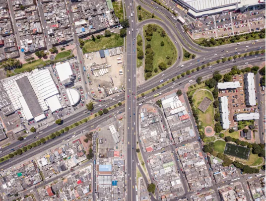
Map the City
- The drones' most significant advantage in public safety is to map the entire town.
- Public Safety Drones for Law Enforcement can capture images before and after the natural disaster strikes. It can locate hot spots, crime areas, suspicious characters, and more.
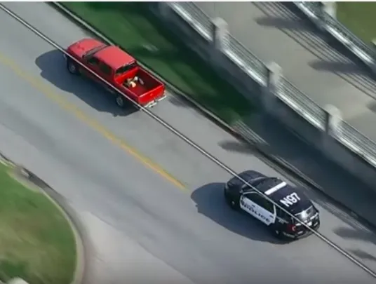
Chasing Suspects
- The use of drones in the public sector is to empower the police department to chase suspects more efficiently.
- Whenever a suspect hides, the ground units find it tough to locate them. This is where drone mapping proves to be a big game-changer.
Crime Scene Investigation
- The crime reconstruction software enables the police department to investigate the crime scene thoroughly, collect evidence, and investigate the case.
- It helps capture images of a crime scene and provides 3D maps and pictures in a few minutes.
- Irrespective of low-light conditions or lighting at night, the ground unit can use drones to conduct a comprehensive investigation.
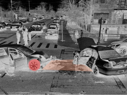
Cars, Planes & Boating Accidents
- Drones help the police visit accident sites virtually and collect all the information they require to investigate the incident from diverse angles.
- It enables gathering pieces of evidence without blocking the traffic.

Want to deploy drones for Aerial Surveillance? Connect with us now!
Dummy div
Social Media
Follow us on social media to find out the latest updates on our progress


