
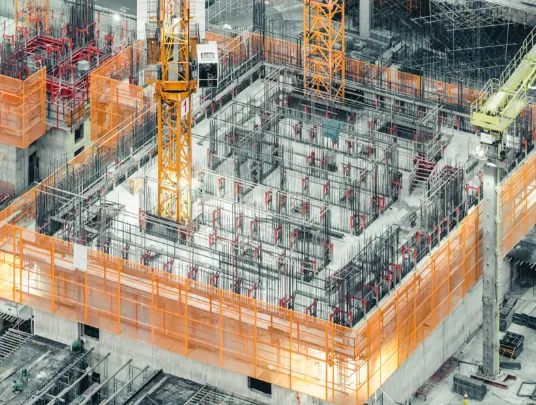
Drones in Construction Industry
Drones have helped make several improvements in the way buildings are constructed in the last few years. Right from increased accuracy to improved safety and cost-cutting, construction drones have revolutionized the construction industry.

At Fly & Tag, our construction drone software is designed to help builders improve efficiency, save time and money, and reduce risk.

From eliminating costly aerial imagery to gathering precise data to building construction map, our drone for site survey does it all.

The construction survey software ensures to manage all your multiple site handling problems, With data accessible in the cloud, it enables you to stay updated and keep a check on work progress from anywhere and at any time.

It encapsulates all the risk prevention measures to help you build a safer environment for your on-site helpers. Once you switch to...more using drones in construction industry, the opportunities and benefits are endless.

If you want to know more about how drones can prove to be a game-changer for inspection & site surveys in construction, reach out to our team today!
What Our Construction Drone Software Has To Offer?
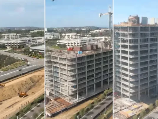
Monitor Progress
- With our construction progress monitoring feature, you can easily keep an eye on the workers’ productivity of all your sites, irrespective of their size.
- Get access to high-quality records and live updates through a comprehensive dashboard.

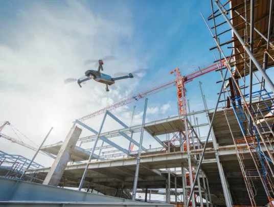
Site Survey in Construction
- Our construction survey software provides you with reliable data to recognize new challenges and opportunities.
- Gather and analyze the most comprehensive data for thorough site modeling & planning via terrain to eliminate any hassles during different phases of a construction project.
Drone Construction Inspection
- Proper data mapping is essential for bridges, railroads, cooling towers, buildings, solar and gas infrastructure.
- Our drone mapping survey software allows you to do it effectively and accurately.
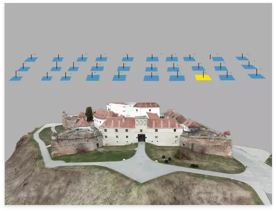
2D/3D Modeling
- The construction drone software conducts construction site aerial photography to provide you with detailed insights.
- It can help identify the various obstacles and utilize the advantage of geo-spatial data.
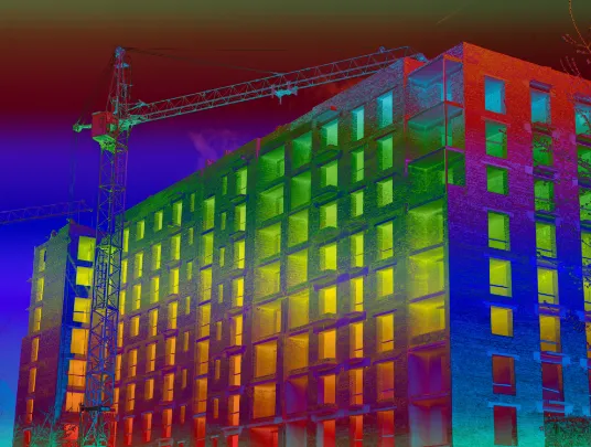
Thermal Imaging
- Thermal imaging to detect faulty structures, leaks, and energy losses, which is typically next to impossible with manual evaluation can be done right with our construction drone.
Whether you want strategic insights from drones regarding your project to make it competitive or want to keep a tap on the progress, we're here to help. At Fly & Tag, we believe in understanding your needs and providing result-driven drone mapping solutions.
Map, Measure, & Report the Progress: Accurate Aerial Data
- Our drones in construction industry help map, measure, and report a complex job site, enabling you to achieve better ground control.
- You can easily know the development without the need to visit the site, thanks to our cloud-based construction drone software.
- Measure grades, heights, and distances identify and prevent the obstacles beforehand, and obtain cut & fill maps for efficient planning of grinding works in a matter of a few seconds with our drone.
- With our construction survey software, you can compare multiple datasets over time, visualize progress, generate CSV or PDF reports and share them with stakeholders and contractors.

Connect with our experts today to learn more about what a construction project mapping software can do for you.
Dummy div
Social Media
Follow us on social media to find out the latest updates on our progress


