
Construction Drone Software
Drive insights and optimize project execution with drones in construction industry.
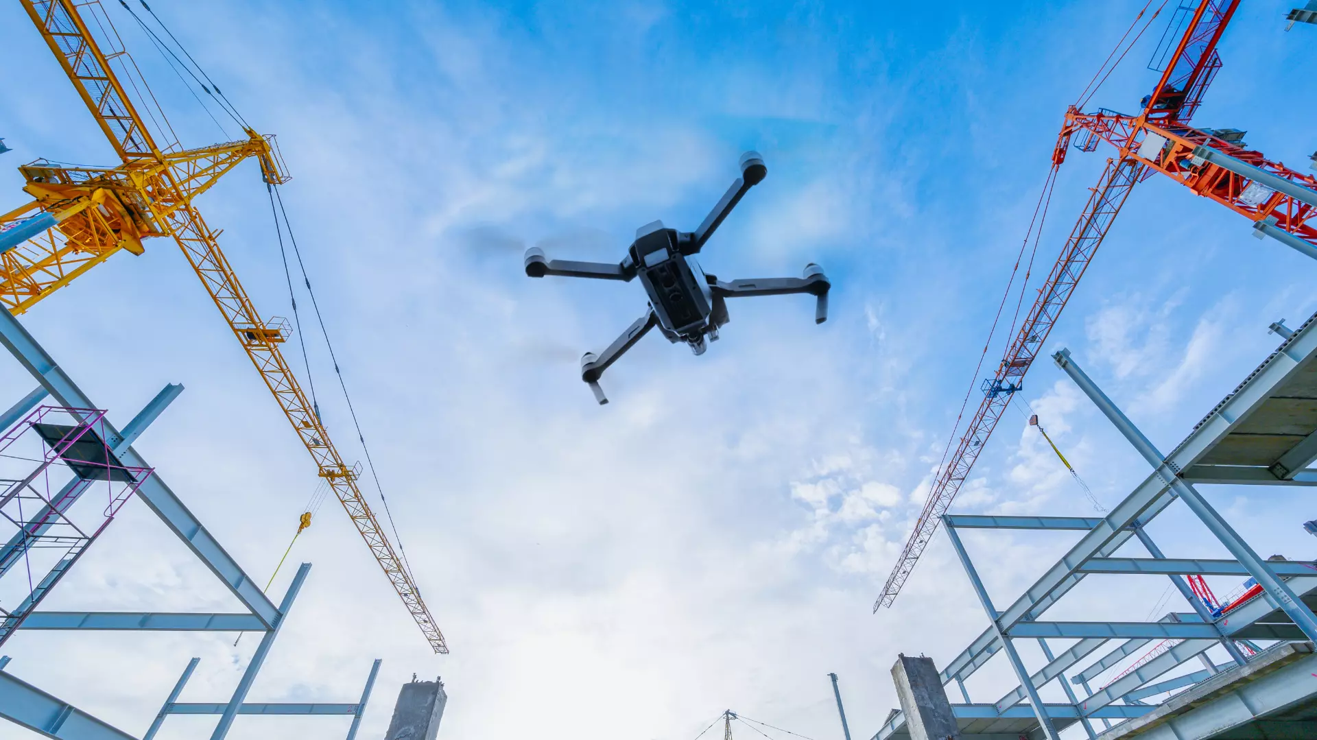
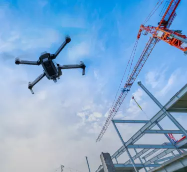
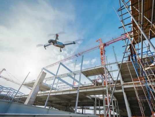
In the past few years, drones have become one of the most popular trends in the construction sector. Be it construction site aerial photography or construction progress monitoring, the construction drone software is a viable tool offering a range of benefits. BuildR, our construction drone, is designed to make day-to-day life easier for people in the construction industry.

Our drone for site survey is built with the ability of visual inspections, real-time data, progress analytics, and more. With BuildR, constructors can control many job sites from a single platform.

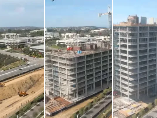
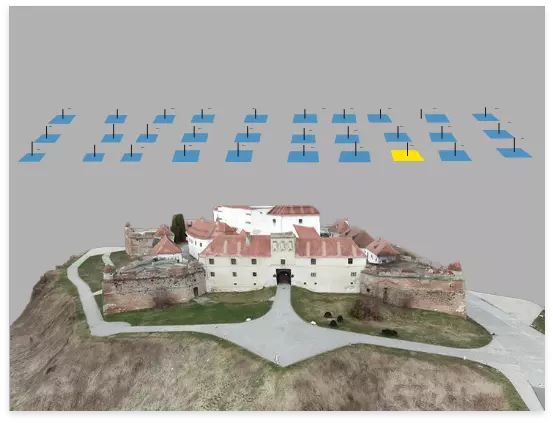
Our construction solutions help transform aerial data into 2D and 3D models, making construction seamless and streamlined. Hundreds of our clients find BuildR beneficial for site survey in construction.
What BuildR Can Help You With?

Building surveillance

Elevation models

Map overlay

Project video

Aerial documentation

2d Orthomosaic

3d SURFACE models

Project monitoring

Volumetric measurements

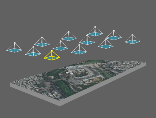
Construction Site Mapping

Quality check
Quality check

Simplify pre-construction, construction, and post-construction processes with our construction drone software. Let's get in touch to unleash more of its potential.
What You Can Expect With BuildR?


High-Accuracy Data
Our construction drone is built with high-end features and functionalities to provide builders with precise topographical data analysis. Get real-time data with visuals and stay in a constant loop with customers.


Faster Data
The construction survey software uses volumetric calculations and analysis as progress indicators to provide accurate and faster data. The data is accessible even while you are away from the site or at a different geographic location.


Excellent Custome Support
Right from the deployment of the construction drone to their integration and post-maintenance, you can rely on our team’s bespoke customer support. We are committed to enriching your experience and offering end-to-end solutions.


No Professional Training
The use of drones in construction industry, especially BuildR, is simple to learn and easy to implement. There’s no need for any professional or technical training to operate it. Also, our support team is just a call away to help you with any concerns.
Our construction drone is built with high-end features and functionalities to provide builders with precise topographical data analysis. Get real-time data with visuals and stay in a constant loop with customers.
The construction survey software uses volumetric calculations and analysis as progress indicators to provide accurate and faster data. The data is accessible even while you are away from the site or at a different geographic location.
Right from the deployment of the construction drone to their integration and post-maintenance, you can rely on our team’s bespoke customer support. We are committed to enriching your experience and offering end-to-end solutions.
The use of drones in construction industry, especially BuildR, is simple to learn and easy to implement. There’s no need for any professional or technical training to operate it. Also, our support team is just a call away to help you with any concerns.
Expedite Construction Projects With Our Construction Drone
Construction Progress Monitoring
- Get insights into the data collected with drone construction monitoring.
- Access multiple sites in real-time from a single platform and make informed decisions.
- Schedule your jobs accordingly and avoid delays or any additional expenses.
Building Construction Map
- Create 2D maps and 3D models from the data gathered through construction site aerial photography.
- Capture volume measurements, conduct visual inspections and determine evacuations and accurate haul costs.
Volumetric Measurement
- With our drones in construction industry, builders and site managers can keep a hawk-eye on the need and consumption of raw materials.
- With the highest accuracy in the volume of the stockpile estimation, ensure an increase in efficiency and decrease in wastage of stocks.
Building Surveillance
- Building inspections and surveillance with our construction drone software reduce all the risks associated with personnel safety.
- BuildR is designed to evaluate every nook and corner of the building. It even helps identify any potentially hazardous scenario for fast and effective decision-making.

Want to see BuildR in action? Book a demo or get in touch with our experts.
Dummy div
Social Media
Follow us on social media to find out the latest updates on our progress


