
Public Safety Drone Solutions
Agencies across the world are steadily embracing drones in one form or the other. Owing to public safety, the use of drones in law enforcement, fire departments, and emergency management agencies is increasing.

Our bespoke drones and public safety solutions can be used to send information on location, crowd monitoring, crime scene mapping, etc.
Police departments can track suspicious objects easily whereas law firms can utilize them for surveillance.

Be it the need for crime scene reconstruction software or forensic drone, our drones suffice it all.
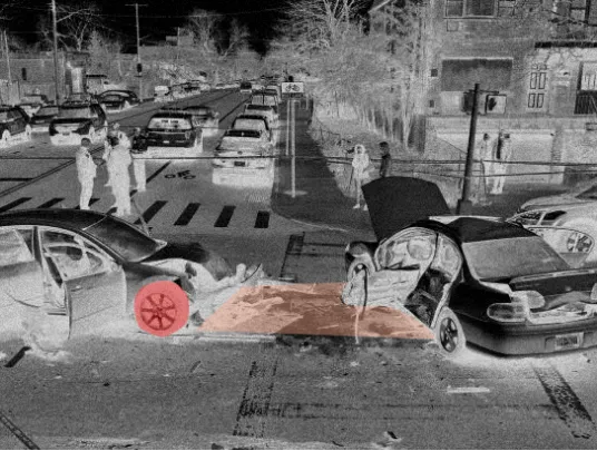
Drones equipped with zoom cameras prove helpful in efficient drone crime scene mapping. With similar features to crime reconstruction software, it allows to get the whole scene, keep a tab on suspicious characters and also help unravel complete details.
Our drone public safety software enables agencies to collect precise information about the crime/accident scene, It also provides valuable insights, letting the team focus on solving the case rather than investing time and energy into revisiting the site again and again.
With our public safety drones, the information captured can be transformed into actionable 2D maps, 3D models, and multiple other formats. As it gives access to all the data online and enables you to share it, the software significantly reduces the paperwork.
Comprehensive Crime Analysis
- Drones and public safety go hand-in-hand. Drones help police and law enforcement departments to analyze crime nearly make data-driven decisions.
- Our crime scene reconstruction software provides a strategic, spatial analysis tool to get detailed information to investigate the case, spot individual faces involved in the crime, or even trace objects found in the scene.
- We enhance crime scene reporting with our drone solutions.
Analyze Crime Patterns
- Our smart software solutions for drones give the most accurate, real-time crime data.
- It identifies the crime hotspots, monitors the crowd, and prepares the law enforcement departments to take preventive measures to control crime.
- Our crime scene software supports strategic, tactical, and investigation analysis, making it easier to share and collaborate information with teams across mobile apps & web maps.
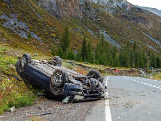
Rapid Accident Reconstruction
- The car crash investigation can take hours, days, and even weeks. The team has to understand if the cause of the accident is a human error, fault in the machinery, or done on purpose.
- Our drone public safety software provides you with the complete data of the accident site without the need to visit the site.
- Agencies can even recreate the accident with our 3D crime scene reconstruction software.
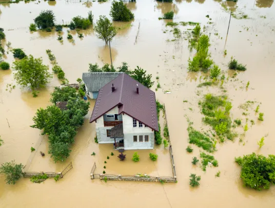
Disaster Management and Relief
- Drones in public safety enable you to study the impact of natural disasters like forest fires, landslides, earthquakes, and other dangerous scenarios.
- With its ability to conduct 3D aerial mapping, it provides the most accurate detailed overview of the damaged spot and helps make informed decisions in aspects like teams required to carry out the relief operation, equipment required, and more.

Looking for complete drone solutions and expert support? Feel free to reach us!
Dummy div
Social Media
Follow us on social media to find out the latest updates on our progress


